At Account Level
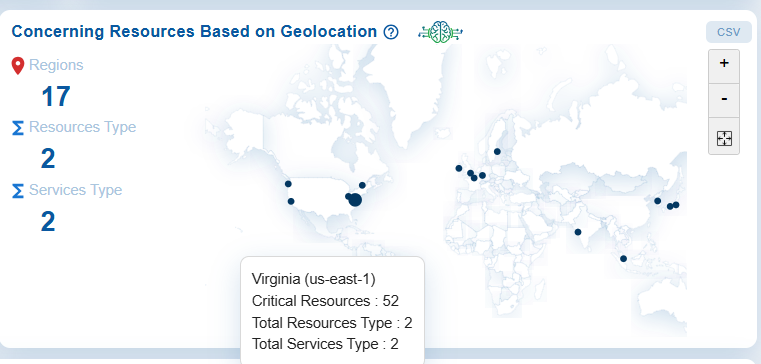
The Concerning Resources Based on Geo Locations chart highlights regions with the highest risk resources. It shows the distribution of these concerning(critical) resources and services across different regions, resource types, and service types, allowing organizations to evaluate the geographic concentration of risks. This information helps organizations proactively monitor regional risk exposure and take targeted remediation measures if risky resources are identified in specific geographic areas.
Markers on the world map indicate the physical locations of monitored resources, enabling a quick visualization of their geographic distribution across North America, Europe, and Asia. Moving your cursor on any of the dots displays the region, CHS score, total resources type, and total services type available in that specific region.
With zoom controls and the ability to export data as a CSV file, this dashboard block allows security teams to assess regional coverage, identify location-specific risks, and prioritize actions based on the distribution of resources and services.
See Also

